Unit 1.5: Groundwater Hydrology (Groundwater Depletion, Contamination, And Governance Failure)
Instructor: Mr. Kartik Omanakuttan
In this Unit 1.5, we examine groundwater — the vast, invisible reserve that constitutes approximately 99% of all accessible liquid freshwater on Earth — and the processes by which it is depleted, contaminated, and governed. Groundwater is, in many ways, the most important water resource that most people know least about. It cannot be seen from a satellite or measured with a river gauge. It responds to extraction and contamination on timescales of years to centuries, long after the decisions driving its degradation have been made and their political beneficiaries have moved on. And its governance — fragmented across land ownership laws, agricultural policies, energy subsidy regimes, and drinking water regulations — is profoundly inadequate for a resource on which approximately half of global drinking water and a quarter of global irrigation depends. This unit situates groundwater hydrology within political economy, public health, food security, and intergenerational equity, with the central argument that groundwater crises are governance outcomes, not natural events.
1.5.1 Participatory Exercise in Forum W-001
Before we begin, we ask every student to post in Forum W-001 at least one observation about groundwater (a depletion problem, a contamination event, a governance failure, or a community practice) from your own country or region.
Do not limit yourself to drought or overuse. Groundwater challenges are diverse: arsenic contamination in alluvial aquifers, nitrate pollution from agriculture, saltwater intrusion in coastal aquifers, land subsidence in cities built on drained aquifers, legal disputes over groundwater rights, the role of energy subsidies in driving overextraction, the collapse of irrigation-dependent rural economies, or the experiences of communities who have lost access to the wells their grandparents dug. Any of these, and many others, are valid contributions.
Task for Instructor/Facilitator: Monitor Forum W-001, compile contributions, and use them to enrich the case study discussions in Section 1.5.4.
1.5.2 Aquifer Systems, Recharge Dynamics and the Mechanics of Silent Depletion
What is Groundwater, and Why Does It Matter?
Before we move ahead, we must understand some concepts first. Groundwater is the water that has infiltrated below the land surface and is stored in the pores, cracks, and fractures of subsurface geological formations called aquifers. An unconfined aquifer is one in direct hydraulic connection with the land surface, recharged by rainfall infiltrating through overlying soils; its upper boundary, the water table, rises and falls with recharge and extraction. A confined aquifer is one sandwiched between impermeable geological layers, often under pressure (artesian wells in confined aquifers may flow naturally without pumping). The distinction matters for governance because confined aquifers are often isolated from recent recharge; water extracted from them may be ancient, thousands to hundreds of thousands of years old, and is effectively non-renewable on any human timescale.
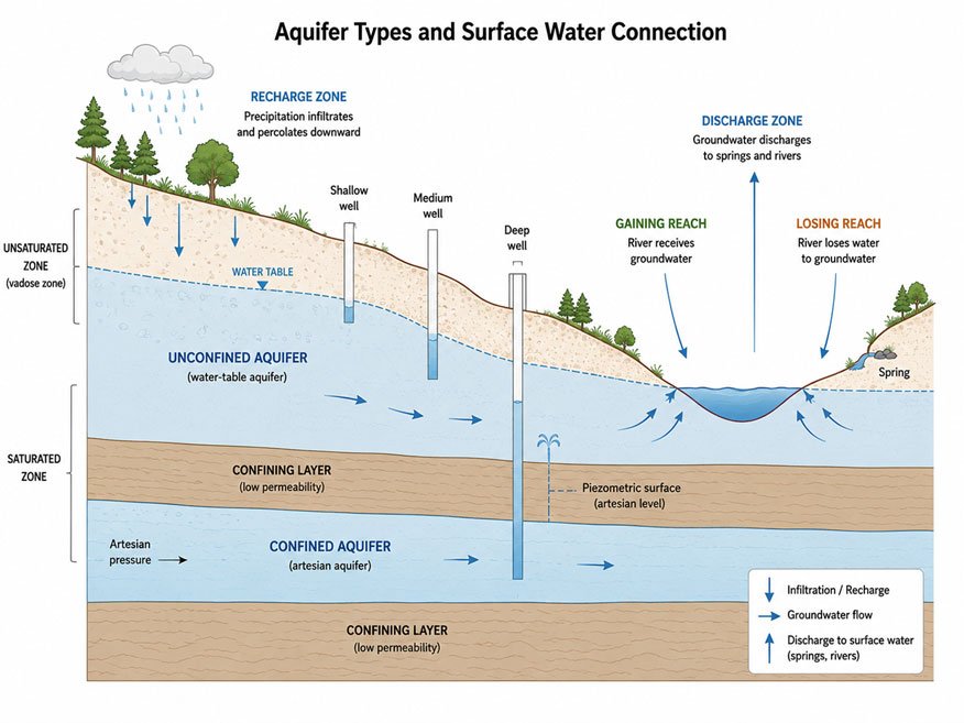
Figure 1.5.1: Cross-section diagram of aquifer types showing an unconfined aquifer with water table, recharge from surface, wells at different depths; a confined aquifer below an impermeable layer with artesian pressure; and the connection between rivers and shallow groundwater (gaining and losing reaches). Source: Kartik Omanakuttan adopted from USGS Water Science Photo Gallery.
Groundwater constitutes approximately 99% of all accessible liquid freshwater on Earth, the remainder being surface water in rivers and lakes. It supplies nearly half of global drinking water and approximately 40% of agricultural irrigation water globally (WWAP, 2022). In many regions (the Indo-Gangetic Plain of South Asia, the North China Plain, the U.S. High Plains, the Iranian plateau, the Arabian Peninsula), groundwater is not supplemental to surface water; it is the primary water source for both agriculture and domestic supply.
Despite this centrality, groundwater remains institutionally marginalised. It is invisible — you cannot walk to a groundwater body and observe its condition the way you can a river or a lake. Its depletion and contamination unfold below the surface and below the threshold of public awareness. Its governance is fragmented across legislation designed for different purposes: land ownership law (because in most countries groundwater rights are tied to surface land ownership), water quality regulations (designed for drinking water safety), agricultural policy (which drives the largest share of groundwater use), and energy policy (because cheap electricity for pumping is the single most important driver of groundwater overextraction in irrigated regions). No single agency oversees groundwater systems as integrated entities, and the result is that nobody is responsible for their long-term health.
The Mechanics of Depletion
Groundwater depletion occurs when extraction consistently exceeds recharge — the rate at which rainfall and surface water infiltrate and replenish the aquifer. The immediate physical manifestation is a declining water table: wells that once reached water at 10 metres now require 20, 30, or 50 metres of drilling. As the water table drops, older, shallower wells fail. Pumping lifts increase, raising energy costs and excluding smaller farmers unable to invest in deeper wells or more powerful pumps. Rivers fed by groundwater discharge experience declining baseflows and eventually cease to flow in dry seasons, as the aquifer no longer sustains them.
Over longer timescales, depletion produces more severe and less reversible consequences. In thick clay-dominated aquifer systems, the drainage of pore water causes the sediment structure to compact irreversibly, a process called land subsidence, permanently reducing the aquifer's storage capacity even if recharge is subsequently restored. Cities built on drained aquifers (Mexico City, Jakarta, Ho Chi Minh City, parts of the San Joaquin Valley in California) have experienced subsidence of metres, damaging infrastructure, increasing flood risk, and in some cases making aquifer restoration physically impossible.
The temporal dynamics of depletion create a governance trap. Benefits of groundwater extraction — expanded irrigation, increased food production, and economic growth — are immediate and concentrated in the communities and businesses that extract the water. Costs — declining water tables, increased pumping costs, well failures, ecological damage, eventual aquifer exhaustion — are distributed over decades and across all users, including future generations who have not yet made any extraction decisions. This temporal mismatch between benefits and costs is the most fundamental challenge in groundwater governance.
Task and Instructions for Participants
All students are advised to watch the following open-access videos carefully before reading the narration section below.
Essential Watch
Conceptual overview of aquifer systems, recharge, and overdraft.
Additional Watch
Global synthesis of groundwater depletion, food security trade-offs, and climate interactions.
While watching, consider: If groundwater recharge is a natural process, why is recharge insufficient to sustain current extraction rates in so many regions?
While watching, ask yourself: Who is presented as a solution provider in this video, and who is absent from the proposed solutions?
Narration: Making the Invisible Visible
For most of human history, groundwater was accessed through hand-dug wells and exploited at rates broadly consistent with natural recharge. Seasonal springs and shallow wells served as buffers against surface water variability, moderating the impact of droughts without permanently depleting the underground reserve. Since the mid-twentieth century, the relationship between humanity and groundwater has been transformed by three technologies operating in combination: high-capacity electric and diesel pumps capable of extracting water far faster than any previous technology; deep drilling equipment able to reach confined aquifers hundreds of metres below the surface; and the green revolution's demand for reliable, year-round water supply for the high-yielding crop varieties that feed the modern world. These technologies, combined with energy subsidies that make pumping artificially cheap in major agricultural nations, converted groundwater from a seasonal buffer into the permanent engine of irrigated agriculture across vast semi-arid regions.
In northwestern India — the Punjab, Haryana, and Rajasthan — intensive groundwater extraction for rice and wheat cultivation has driven water table declines of one to three metres per year in some districts, drawing on a resource that recharges at a fraction of that rate. GRACE satellite data, which measures small changes in Earth's gravity field caused by water mass changes, confirmed between 2002 and 2008 the loss of approximately 17 km3 per year of groundwater from this region — more water than India's largest surface reservoir holds (Rodell et al., 2009). Underneath the celebrated grain production of India's breadbasket, an irreplaceable resource was quietly disappearing. Similar trajectories are documented in the North China Plain, where groundwater for wheat and maize production has dropped the water table beneath Beijing-adjacent areas by tens of metres; in Iran, where intensive abstraction has caused land subsidence in major agricultural provinces; in the Arabian Peninsula, where fossil aquifers accumulated over millennia are being depleted within decades for wheat cultivation in desert environments; and in California's San Joaquin Valley, where decades of groundwater overdraft have caused measurable land subsidence and the compaction of irreplaceable aquifer storage capacity.

Figure 1.5.2: Water scarcity in India's arid regions. Source: Pixabay
What these regions share is not hydrology but governance: a combination of legal frameworks that treat groundwater as a private resource attached to land ownership, energy pricing policies that artificially depress pumping costs, agricultural support structures that incentivise intensive production, and monitoring systems too sparse to provide meaningful early warning of aquifer decline. The depletion is not happening despite these policies. It is happening because of them.
Reflective Questions (Mandatory for all students)
Post your reflections in Forum W-001 under the tag "Reflective Questions 1.5".
- In your country or region, is groundwater use regulated — meaning are there limits on how much can be extracted, by whom, and under what conditions? If regulations exist, are they enforced? What does this tell you about how groundwater is understood as a resource — commons, private property, or something else?
- Why does groundwater depletion typically remain politically invisible until wells fail and an acute economic or water supply crisis forces attention? Who benefits from this invisibility?
- How would the governance of groundwater need to change to protect the interests of future generations, who will inherit whatever is left?
1.5.3 The Cascading Consequences of Groundwater Misuse
Depletion: Cascading Consequences
Groundwater depletion destabilizes water security, agricultural livelihoods, and ecological systems simultaneously. As the water table declines, the consequences propagate outward from individual wells to entire agricultural economies and the ecosystems they overlay.
At the farm scale, the first effects are economic. Pumping depth increases, raising energy costs and making groundwater-dependent agriculture progressively less profitable for all users. But the burden is unevenly distributed: larger, wealthier farmers can afford to drill deeper and invest in more efficient pumps. Smaller farmers and marginal users (those with older, shallower wells and tighter operating margins) find their wells failing first. They are excluded from the resource before the aquifer's decline has become a crisis visible to policymakers. This pattern, the progressive exclusion of smaller and poorer users as depletion deepens, is documented in irrigated groundwater systems from India to Mexico to sub-Saharan Africa (Mehta, 2005; Shah, 2010). It represents a systematic redistribution of a shared resource from poorer to wealthier users, driven not by any explicit policy decision but by the differential capacity to invest in deeper drilling.
At the landscape scale, declining water tables disconnect aquifers from the rivers and wetlands that depend on groundwater discharge for their dry-season flows. Streams that were "gaining", sustained by groundwater seeping into the channel, become "losing" or cease to flow altogether. Wetlands sustained by shallow groundwater desiccate. Spring-dependent ecosystems, rich in endemic species adapted to the stable, cool, mineral-rich conditions of groundwater discharge, collapse. The biodiversity losses associated with groundwater depletion are largely invisible; they occur in habitats far from the agricultural fields where the extraction is happening, but they are real and frequently irreversible.
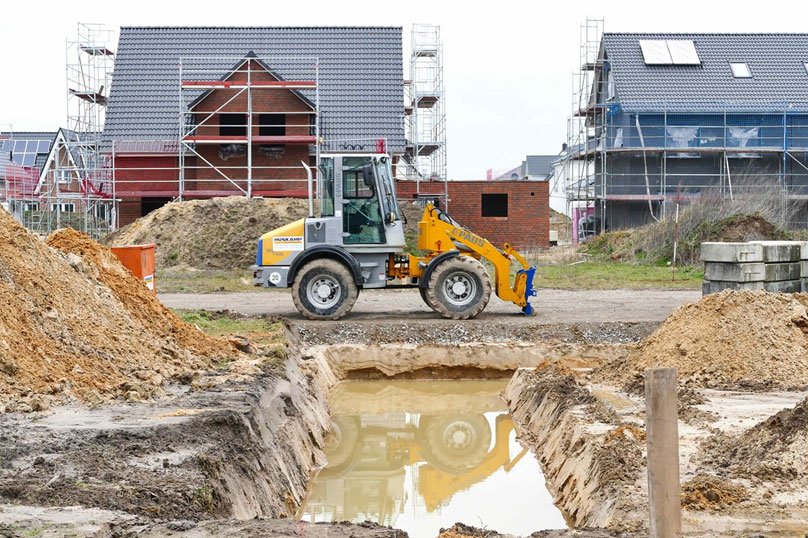
Figure 1.5.3: The hidden biodiversity loss associated with groundwater depletion mostly results from human-led activities. Source: Pixabay
Land subsidence, discussed above, represents perhaps the most permanent legacy of groundwater overextraction. In parts of the San Joaquin Valley, subsidence has exceeded nine metres over a century of intensive pumping, destroying irrigation canal infrastructure, cracking buildings and roads, and permanently reducing the aquifer's capacity to store water. No amount of subsequent recharge can restore compacted clay layers.
Contamination: The Chemical Dimensions of Groundwater Crisis
Groundwater depletion is widely recognized as a crisis; groundwater contamination receives less attention but affects more people more directly. Unlike surface water contamination (which is visible, measurable, and politically attributable), groundwater contamination is invisible, detected only through testing, and often geographically diffuse.
Arsenic contamination is perhaps the most significant naturally occurring groundwater contaminant globally. In alluvial aquifers formed by river sediments — including vast areas of the Ganges-Brahmaputra-Meghna basin in Bangladesh, West Bengal, Bihar, and other parts of South Asia, as well as in parts of Southeast Asia, South America, and the USA — arsenic is naturally present in sedimentary particles laid down from erosion of arsenic-bearing rocks. Under the reducing (low-oxygen) conditions of shallow alluvial aquifers, arsenic is mobilised from sediment particles into groundwater in dissolved form. The World Health Organisation estimates that approximately 140 million people across at least 70 countries have been drinking water containing arsenic above the WHO provisional guideline value of 10 µg/L (WHO, 2022). Chronic arsenic exposure causes skin lesions, elevated risks of skin, bladder, and lung cancers, cardiovascular disease, and neurological damage; developmental effects on children, including impaired cognitive development, have also been documented.
- Agricultural contamination from nitrate, pesticides, and veterinary pharmaceuticals represents a diffuse but pervasive groundwater quality threat in intensively farmed regions. Nitrate, derived from fertiliser application and animal waste, infiltrates through soils into unconfined aquifers, where it accumulates over years and decades. Once an aquifer becomes nitrate-contaminated, remediation is technically challenging and economically prohibitive. Nitrate in drinking water is associated with methaemoglobinaemia (blue baby syndrome) in infants and, at chronically elevated concentrations, with increased cancer risk.
- Saltwater intrusion contaminates coastal aquifers when overextraction draws the freshwater-saltwater interface inland, rendering formerly freshwater supplies too saline for drinking or irrigation. This process is already affecting coastal aquifer systems in South and Southeast Asia, the Mediterranean, small island states, and parts of sub-Saharan Africa — and will be accelerated by sea-level rise under climate change scenarios.
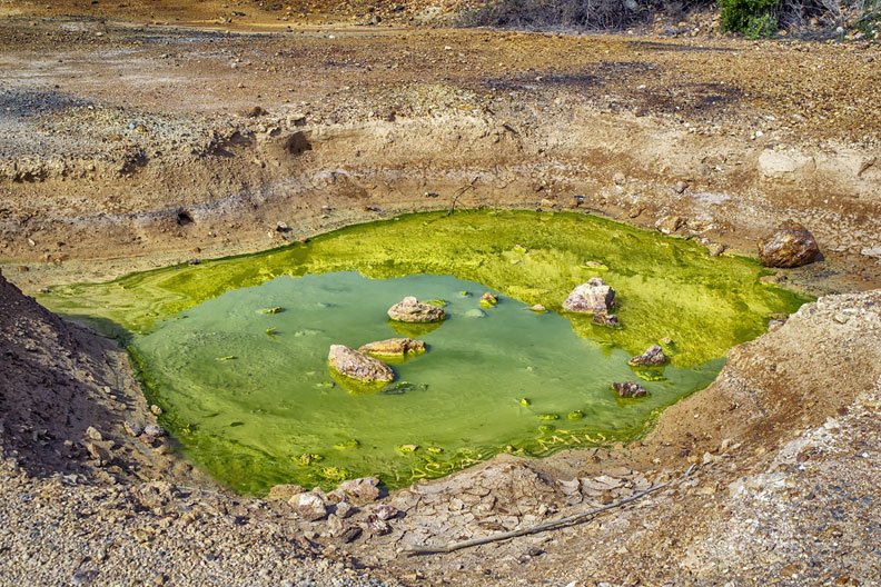
Figure 1.5.4: Polluted waterbody as a result of anthropogenic contamination. Source: Pixabay
Unlike surface water pollution, groundwater contamination is extremely difficult to remediate. Contaminants persist for decades to centuries, bound to sediment particles or slowly migrating through the aquifer matrix. Communities with contaminated groundwater must either find alternative supplies (costly deep wells, piped systems, or point-of-use treatment) or continue drinking water that damages their health. These choices fall with particular severity on the poor, who lack the resources to pay for alternatives and who lack the political voice to demand public solutions.
1.5.4 Case Studies: Groundwater as a Socio-Political Crisis
Groundwater crises are not natural phenomena. They are governance outcomes — the predictable product of systems in which extraction is profitable, monitoring is weak, regulation is capture-prone, and the communities who bear the costs of depletion and contamination are marginalised from the decisions that drive them.
Instructions for Students
Read the following case carefully. Note that it involves a large-scale public health failure produced not by industrial contamination but by a public health intervention — tube well installation — that, while solving one problem, unknowingly created another. After reading, contribute to a discussion in Forum W-001 under the tag "Case Study 1.5-A", focusing on what this case reveals about the governance of groundwater quality.
Case Study 1: Arsenic Contamination in South and Southeast Asia
Case Study 1.5-A — Arsenic in Alluvial Aquifers of the Ganges–Brahmaputra–Meghna Basin
In the 1970s and 1980s, international development agencies and national governments across South and Southeast Asia undertook a large-scale programme to reduce waterborne disease by replacing contaminated surface water sources with tube wells — simple pipes driven or drilled into shallow alluvial aquifers, providing hand-pump access to groundwater that was assumed to be safe. The intervention was a public health success by the metrics it targeted: infant mortality from diarrhoeal disease fell sharply in communities that shifted from surface water to groundwater. What the programme did not test for was arsenic.
Beneath vast areas of the Bengal delta — crossing the national borders of Bangladesh, West Bengal, Bihar, and parts of neighbouring states — shallow alluvial sediments deposited by the Himalayan river system contain naturally occurring arsenic. These sediments were laid down in reducing (anoxic) conditions under ancient floodplains; under the low-oxygen conditions of shallow alluvial aquifers, arsenic is mobilised from mineral particles into groundwater in dissolved form, reaching concentrations far above the WHO guideline value of 10 µg/L in millions of wells across the region.
The scale of the resulting public health crisis is without modern parallel. The WHO estimates that approximately 140 million people in at least 70 countries are exposed to arsenic above guideline levels in their drinking water (WHO, 2022), with the Bengal basin containing the largest affected population. Smith et al. (2000), in their landmark bulletin review, described the situation in Bangladesh as "the largest poisoning of a population in history." That phrase is not hyperbole. In districts of Bangladesh where arsenic prevalence is highest, decades of chronic exposure have translated into elevated rates of arsenical skin lesions — keratosis and hyperpigmentation — that are visible on the skin of many adults, along with elevated mortality from skin, bladder, and lung cancers and from cardiovascular disease. Studies in some districts have documented measurable effects on children's cognitive development.
The crisis unfolded in several stages that reveal distinct governance failures.
The first failure was the absence of baseline arsenic testing during the tube well programme's roll-out. Arsenic testing was not routine in international well-drilling guidelines of the period; it was not considered a significant groundwater contaminant in alluvial settings. This was a knowledge gap, but it was also a governance gap: no institutional mechanism existed to require testing for contaminants not on a standard checklist, and no single agency had responsibility for the long-term quality monitoring of the wells being installed.
The second failure was the fragmented response once the contamination was discovered, gradually in the 1990s, and with increasing scientific and public attention after landmark studies in the late 1990s and early 2000s. Responsibility for addressing the problem cuts across public health agencies, rural water supply authorities, agricultural departments (because irrigation water is a vector of arsenic accumulation in rice), local government bodies, international donors, and NGOs. No agency had a mandate to coordinate the response, and the result was decades of partial, poorly integrated interventions: testing and marking wells (red for unsafe, green for safe), sinking deeper wells intended to draw from less arsenic-affected deeper aquifers, installing community-scale piped supply systems, promoting pond sand filters and other point-of-use treatment technologies. Each intervention addressed part of the problem and created new complications. Deep wells, initially assumed to tap arsenic-free water, have in some areas been found to contain elevated arsenic or manganese. Piped supply systems reach urban and peri-urban areas more easily than dispersed rural communities. Testing and marking programmes require sustained maintenance that often lapses. Point-of-use treatment requires behavioural change and ongoing filter maintenance that are difficult to sustain in resource-poor households.

Figure 1.5.5: The arsenic in the Ganga River basin affects the lifeforms dependent on it. Source: Pixabay
The third failure, still unresolved, is institutional. Arsenic exposure continues for millions of people, decades after the problem was scientifically identified, because no adequate funding mechanism, no sufficiently powerful institution, and no political constituency with the strength to demand comprehensive solutions has emerged. The affected communities are overwhelmingly rural, poor, and politically marginalized. They are not the constituents whose demands drive national water policy.
A woman in Faridpur district, Bangladesh, whose daughter had developed the characteristic skin lesions of arsenicosis, described her water situation in a community health interview: "We tested the well. It is red. But the next safe well is far, and the rope is old. We drink what is near." In that single statement lies the governance failure: a household aware of the risk, unable to act on it, bearing the cost of a crisis produced by decisions made decades earlier at a scale far beyond their influence.
Looking forward, climate change adds a further dimension of risk. Changes in monsoon intensity, sea-level rise, and altered groundwater recharge patterns may shift arsenic mobilisation dynamics in ways that are difficult to predict, potentially expanding affected areas or intensifying concentrations in existing hotspots (Mukherjee et al., 2019).
Case Study 2: Aquifer Depletion and Food Security Trade-offs Reading Exercise
Before reading the following case, download and read the USGS resource on groundwater decline and depletion (USGS, 2018) and the relevant section of the UN World Water Development Report (WWAP, 2022) on food security and groundwater. Come to the case with a clear sense of the physical basis of the problem. The task is to assess whether gradual depletion is preferable to managed transition.
Instructions for Students
Read the case below and consider the intergenerational equity dimensions of aquifer depletion — the question of who decides how much of a shared, slowly-replenishing resource can be consumed in a single generation. Post your reflections in Forum W-001 under the tag "Case Study 1.5-B".
Case Study 1.5-B — Aquifer Depletion and Food-Security Trade-offs: The Ogallala (High Plains) Aquifer
Beneath the Great Plains of the United States — across Kansas, Nebraska, Colorado, Oklahoma, Texas, New Mexico, South Dakota, and Wyoming — lies the Ogallala Aquifer, the largest groundwater system in North America. It stores approximately 3.7 billion acre-feet of water, accumulated primarily during and after the last ice age in a geological formation that recharges at a rate vastly slower than current extraction: natural recharge averages perhaps one to six centimetres per year, while extraction for irrigation exceeds fifty centimetres per year in much of the system.
The agricultural transformation that the Ogallala enabled is remarkable. Centre-pivot irrigation — the circles of green visible from aircraft across the Kansas plains — converted one of the world's most drought-prone agricultural regions into one of its most productive. The High Plains aquifer underlies land that produces approximately one-fifth of total U.S. agricultural output, including large shares of national beef, cotton, wheat, corn, and sorghum production. Rural communities, towns, and regional economies were built on the assumption that this water would remain available.
That assumption is being tested. The U.S. Geological Survey documents groundwater level declines of more than 50 metres (approximately 150 feet) in parts of the southern High Plains — in southwest Kansas and the Texas Panhandle — where the aquifer is thinnest, and depletion has been most intensive (USGS, 2018). Locally, the aquifer is nearly exhausted; some shallow reaches have already been abandoned. In the southern portions of the aquifer, saturated thickness has declined by more than 50% from pre-development levels, and the remaining water will be economically inaccessible within decades at current rates of use. In the northern aquifer — beneath Nebraska, where natural recharge is somewhat higher — conditions are less immediately dire but not stable.
The social consequences of depletion are already visible. As water tables fall and pumping lifts increase, operating costs rise. The threshold depth at which groundwater extraction is economically viable depends on the crop being irrigated, energy prices, and commodity prices; as the table drops below that threshold, irrigated agriculture must convert to dryland production or cease entirely. Fields that once yielded 200 bushels of corn per acre under irrigation may yield 40 under dryland conditions, a 70–80% decline in output per unit area. Farm incomes collapse; rural businesses serving agricultural communities close; young people leave; towns shrink.
Who can continue the longest? Those with the deepest wells and the greatest capital to invest in efficiency: larger operations, corporate farms, and those with access to credit. Smaller family farmers, facing the same declining water table but with less capital to adapt, exit irrigated production first — selling land or simply abandoning irrigation. The gradual depletion of the Ogallala is thus also a gradual redistribution of agricultural capacity from smaller to larger operators, driven not by explicit policy but by differential access to capital in the face of a shared declining resource.
The governance architecture of the Ogallala region compounds these dynamics. In most U.S. states overlying the aquifer, groundwater rights are treated as property attached to land: a landowner has the right to pump groundwater from beneath their land, subject to the rule of "reasonable use" (or, in Texas, the common law rule of capture — the right to extract whatever you can reach, regardless of harm to neighbours). These doctrines, rooted in nineteenth-century agricultural law, were designed for conditions of relative groundwater abundance. Applied to an overexploited aquifer, they produce a race-to-pump dynamic: because extraction by one user reduces the resource available to others, each user has an incentive to pump as much as possible before the aquifer is depleted by their neighbours.
Local groundwater management districts in Kansas and Nebraska have experimented with extraction limits, pumping restrictions, and voluntary water-sharing agreements. Some have achieved measurable reductions in depletion rates. But these efforts operate against an institutional current that favours extraction: farm lobby resistance to restrictions, political cultures that valorise individual property rights, commodity market incentives favouring high-yield irrigated crops, and federal crop insurance programmes that cushion farmers against drought losses that might otherwise accelerate adaptation.
Researchers have framed the Ogallala dilemma starkly: "The groundwater resource with the greatest long-term depletion is the High Plains (Ogallala) Aquifer... where groundwater levels have declined by more than 50 meters (150 feet) in some areas" (USGS, 2018). What the technical data does not capture is the intergenerational injustice embedded in this trajectory. Water accumulated over ten thousand years is being consumed in roughly a century. The generation that extracted it received the benefits — agricultural wealth, regional economic growth, and food security. Future generations will inherit the depleted aquifer. They did not participate in the decisions that drove depletion, and they will have no access to the water that made those decisions profitable.
This is perhaps the starkest expression of the intergenerational equity problem in water governance: present gains financed by depletion of a resource that future generations will inherit, profoundly diminished.
Mandatory Quiz: [Click Here]
Livestream Zoom Session with Dr. Hasrat Arjjumend
Topic: Governing the Invisible — Community and Policy Approaches to Groundwater Management
Date: 10 July 2026
Time: 16.30 Hours Central European Time (CET)
Zoom Meeting ID: 853 1822 2474 | Passcode: 187155
Prerequisite: Download and read the session note PDF before joining. The session will cover practical groundwater governance approaches from South Asia.
1.5.5 Rights Frameworks, Energy Subsidies, and Structural Drivers of Overextraction
Groundwater governance is institutionally fragmented, historically under-resourced, and structurally biased toward extraction. Understanding the policy instruments that shape groundwater outcomes requires first understanding why these instruments have, in most countries, been designed to enable extraction rather than to constrain it.
Groundwater development was historically promoted as a public good — expanding access to water for agriculture, drinking supply, and industrial use in regions where surface water was scarce or unreliable. Governments in major irrigating nations subsidised drilling, pumping equipment, and energy costs, building the infrastructure of groundwater dependence as a development policy. The regulatory frameworks designed to accompany this development were secondary considerations, frequently drafted after the development had already occurred, and consistently less politically powerful than the agricultural and energy lobbies that benefited from minimal regulation.

Figure 1.5.6: Child collecting groundwater in Katsina, Nigeria — emblematic of how state-subsidized drilling and energy policies historically framed extraction as a public good, embedding rural dependence on wells while regulatory safeguards remained secondary. Source: Pexels
The result is a global governance landscape in which:
- Groundwater rights are attached to land ownership in most common law systems, effectively converting a shared, connected aquifer into a collection of private extraction entitlements. The aquifer's total storage and sustainable yield are not legally recognised; individual rights are not summed against the available resource. This creates the structural basis for the race-to-pump dynamic documented in the Ogallala and countless other depleted aquifer systems.
- Monitoring is sparse and often non-existent. Most countries lack adequate networks of monitoring wells to track water table trends with the spatial and temporal resolution needed for governance. In the absence of monitoring data, regulators cannot demonstrate that depletion is occurring, and affected communities cannot document the harm they are experiencing. Invisibility of the resource reinforces invisibility of the governance failure.
- Abstraction is rarely metered. Even where extraction limits legally exist, enforcement is typically impossible without metering of individual wells. In most major aquifer systems globally, pump meters are absent or routinely tampered with, and volumetric pricing of groundwater extraction — which would create financial incentives for efficiency — is a political rarity.
- Energy subsidies drive overextraction. In India, Pakistan, Bangladesh, and other major irrigating nations, electricity for agricultural pumping is heavily subsidised or supplied free to rural voters as an electoral commitment. The effective cost of pumping is therefore decoupled from the volume extracted, eliminating the price signal that would otherwise moderate use. Attempts to reform energy subsidies in these countries have consistently failed against the political power of the farm lobby.
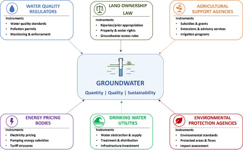
Figure 1.5.7: Governance fragmentation in groundwater management — a schematic showing the different agencies and instruments affecting groundwater (water quality regulators, land ownership law, agricultural support agencies, energy pricing bodies, drinking water utilities, environmental protection agencies) and their typically weak or absent coordination.
Key Policy Instruments
Groundwater Acts and Well Permitting Systems provide the legal basis for regulating extraction in countries with developed water law. Where functioning, permit systems can cap total extraction at sustainable yield levels, require metering and reporting, and provide the legal basis for enforcement. The EU Groundwater Directive (2006/118/EC) and Australia's National Water Initiative (2004) represent examples of policy frameworks that attempt to embed ecological sustainability into groundwater governance — though implementation has been imperfect and contested. Transboundary Aquifer Agreements are needed wherever significant aquifers cross national boundaries — which is common, as aquifer geology respects no political borders. The UN International Law Commission's Draft Articles on the Law of Transboundary Aquifers (2008) represent the most developed international framework for transboundary groundwater governance, establishing principles of equitable and reasonable use, the obligation not to cause significant harm, and the duty to cooperate. These are non-binding, and most transboundary aquifer systems remain without effective bilateral or multilateral governance arrangements.
Aquifer Governance Boards and Community Management Institutions represent a different governance logic — self-organisation by groundwater users at the scale of the aquifer, rather than top-down state regulation. Where social capital is high, and users can credibly commit to extraction limits, community management can achieve sustainable use without formal state regulation. Ostrom's (1990) framework for governing common pool resources identifies the institutional conditions — clearly defined boundaries, proportional equivalence between benefits and costs, collective choice arrangements, monitoring, and graduated sanctions — that make self-governance of shared resources possible. Groundwater, as a common-pool resource, meets the conditions in principle; whether it can be governed communally in practice depends on the social and political context.
The Energy-Groundwater Nexus
No account of groundwater governance instruments is complete without addressing the relationship between energy policy and groundwater extraction. Where electricity for pumping is cheap or free — particularly in South Asia, where agricultural power subsidies are deep and politically entrenched — extraction rates are essentially responsive only to drilling depth and aquifer productivity, not to price. A flat-rate agricultural electricity tariff (pay by connection, not by consumption) provides the same financial incentive to pump whether the water table is at 10 metres or 80 metres, which means there is no market signal to moderate use as the aquifer declines.
Reform of agricultural energy subsidies is thus inseparable from groundwater governance reform. But energy subsidy reform is politically explosive — subsidies are received by millions of small farmers who have organised their farming systems around cheap water, and politicians who have built electoral coalitions on the promise of free power are extremely reluctant to withdraw it. The political economy of groundwater governance is, in large part, the political economy of energy subsidy reform.
Task for Participants
Examine the groundwater governance framework in your country or region. In Forum W-001 under the tag "Policy Analysis Task 1.5", post a brief analysis addressing:
- Whether groundwater rights in your jurisdiction are treated as private property, public property, or a commons, and what governance consequences this has.
- Whether meaningful extraction limits exist, and if so, how they are monitored and enforced.
- What role do energy subsidies play in shaping groundwater use in your region?
1.5.6 Fragmentation of Groundwater Systems and Impacts of Unregulated Extraction
Understanding Groundwater Fragmentation
Groundwater fragmentation does not manifest physically in the way that river fragmentation does — there are no dams blocking underground flows. It is institutional and hydrological simultaneously.
Institutional fragmentation arises because groundwater is extracted through thousands of individual wells, each operating as an isolated extraction point, while the aquifer responds to extraction collectively. The decision made by each individual user — how much to pump, when, from what depth — affects the water table experienced by all other users, yet no governance mechanism aggregates these individual decisions against the aquifer's sustainable yield. Sectoral governance separates agricultural water use, municipal water supply, industrial extraction, and environmental protection into different regulatory silos, each managing its own domain without accounting for their combined effect on the aquifer as a shared system.
Hydrological fragmentation occurs when heavy pumping creates localised cones of depression — areas where the water table has been drawn down well below surrounding levels by intensive extraction — disrupting the natural flow of groundwater toward rivers and springs. Rivers in areas of heavy pumping shift from gaining (receiving groundwater inputs) to losing (losing water into the depleted aquifer). Springs fed by groundwater discharge cease to flow. Wetlands sustained by shallow groundwater dry out. These hydrological disconnections ripple through ecosystems and human systems. Riparian vegetation dependent on shallow groundwater dies. Stream flows that sustained aquatic communities are reduced or eliminated. Agricultural and domestic wells drawing from the same water table as the depleted zone experience declining yields and rising costs.
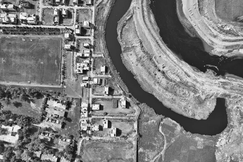
Figure 1.5.8: River near homes in Kala Shah Kaku, Pakistan — contrasting visible river continuity with hidden groundwater fragmentation. Source: Pexels
The Race to the Bottom: Depletion Dynamics
Where individual extraction rights are poorly defined, weakly limited, and collectively unsustainable, groundwater governance tends to produce what economists recognise as a race to the bottom — a dynamic in which each user extracts as fast as possible, not out of irrationality, but out of rational response to the structure of the resource regime. If your neighbour is pumping aggressively, you lose the water they pump whether you moderate your own use or not. The only way to ensure access to the resource is to extract it before someone else does. This logic, applied simultaneously by thousands of users, produces exactly the collective overextraction that destroys the resource for all.
Breaking the race-to-the-bottom dynamic in groundwater governance requires one of two things: either a credible institutional authority capable of capping total extraction and enforcing individual limits against the resistance of users who gain from current extraction rates; or the social conditions — trust, shared identity, effective monitoring, graduated sanctions — that allow communities of users to self-organise credible extraction constraints without state coercion. Neither is easy to achieve. Both are possible, as documented examples of functioning groundwater governance — some state-led, some community-based — demonstrate.
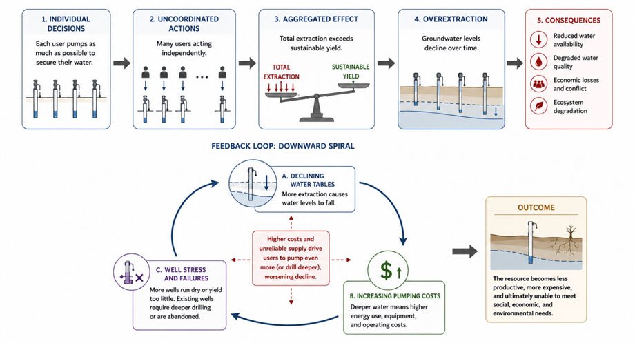
Figure 1.5.9: Illustration of how uncoordinated individual extraction decisions aggregate to collective overextraction beyond sustainable yield, with the feedback loop of declining water tables, increasing pumping costs, and well failures that follows.
Ecological Consequences of Groundwater Depletion
The ecological consequences of groundwater depletion extend well beyond the agricultural systems that drive most extraction. Groundwater-dependent ecosystems — wetlands, springs, seeps, riparian woodlands, river baseflows — depend on groundwater discharge for their existence. As water tables decline, these ecosystems are progressively disconnected from their subsurface water source.
Globally, groundwater-dependent ecosystems include some of the world's most biodiverse and specialized habitats: spring-fed streams in arid regions with endemic fish species found nowhere else; peatland systems sustained by high groundwater levels; riparian forests along dryland rivers whose roots reach the water table; and subterranean aquatic ecosystems with extraordinary communities of specialized invertebrates. Many of these ecosystems have no surface water connection and no resilience to groundwater depletion — when the water table drops below their biological threshold, they collapse, often within years.
These collapses are largely unwitnessed and unrecorded — they happen underground, or in remote arid-land springs, or in the gradually drying streambed of a rural watercourse that nobody monitors. They are the invisible ecological cost of a governance system that treats groundwater as a private resource to be extracted for profit, without accounting for its role in sustaining the living systems above and around the aquifer.
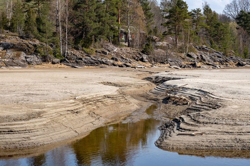
Figure 1.5.10: Dried stream bed in woodland — a quiet marker of groundwater-dependent ecosystems collapsing as aquifers disconnect. Source: Pexels
Wrap Up Unit 1.5: Synthesis and Reflection
Please prepare a brief synthesis and post in Forum W-001 under the tag "Wrap Up Unit 1.5":
- One insight about groundwater — hydrological, governance-related or equity-related — that changes how you understand a water issue in your professional context.
- One example of groundwater depletion or contamination that is documented or that you have observed in your region, and your assessment of the governance failures that have allowed it to persist.
- Whether groundwater governance in your country prioritises long-term sustainability or short-term extraction, and what interests are served by whichever it is.
Closing Note
Groundwater crises share a feature with the worst governance failures: they are invisible until they are irreversible. When a river runs dry, there is a picture. When an aquifer is exhausted, there are only rising costs, failing wells, and communities whose agricultural system has collapsed. The politics of groundwater reform are as difficult as any in water governance — requiring confrontation with agricultural interests, property rights regimes, and energy subsidy politics that have been entrenched for decades. But the window for meaningful transition is narrowing in every major overexploited aquifer system in the world. Understanding groundwater governance is, therefore, not only a scientific challenge but an urgent political and ethical one.
Selected core readings and references:
Tracy, J., Johnson, J., Konikow, L., Miller, G., Porter, D. O., Sheng ZhuPing, S. Z., & Sibray, S.
(2019). Aquifer depletion and potential impacts on long-term irrigated agricultural productivity. https://cast-science.org/wp-content/uploads/2024/08/CAST-IP63-Aquifer-Depletion.pdf
Bowman, W. M. (2020). Dustbowl Waters: Doctrinal and Legislative Solutions to Save the
Ogallala Aquifer Before Both Time and Water Run Out. U. Colo. L. Rev., 91, 1081. https://papers.ssrn.com/sol3/Delivery.cfm?abstractid=3475565
Kemper, K. E. (2007). Instruments and institutions for groundwater management.
Mechlem, K. (2016). Groundwater governance: The role of legal frameworks at the local and
national level—Established practice and emerging trends. Water, 8(8), 347. https://doi.org/10.3390/w8080347
Perez, N., Singh, V., Ringler, C., Xie, H., Zhu, T., Sutanudjaja, E. H., & Villholth, K. G. (2024).
Ending groundwater overdraft without affecting food security. Nature Sustainability, 7(8), 1007-1017. https://doi.org/10.1038/s41893-024-01376-w
Cited References:
Smith, A. H., Lingas, E. O., & Rahman, M. (2000). Contamination of drinking-water by arsenic in
Bangladesh: a public health emergency. Bulletin of the world health organization, 78(9), 1093-1103. https://www.scielosp.org/pdf/bwho/v78n9/v78n9a05.pdf
United Nations World Water Assessment Programme (WWAP). (2022). The United Nations World
Water Development Report 2022: Groundwater – Making the invisible visible. UN-Water. https://www.unwater.org/publications/un-world-water-development-report-2022
World Health Organization (WHO). (2022). Arsenic. WHO Fact Sheets.
https://www.who.int/news-room/fact-sheets/detail/arsenic
Mehta, L. (2005). The politics and poetics of water: The naturalisation of scarcity in Western
India. Orient Blackswan. https://tinyurl.com/3xurzf6d
Rodell, M., Velicogna, I., & Famiglietti, J. S. (2009). Satellite-based estimates of groundwater
depletion in India. Nature, 460(7258), 999-1002. https://doi.org/10.1038/nature08238
Mukherjee, A., Gupta, S., Coomar, P., Fryar, A. E., Guillot, S., Verma, S., ... & Charlet, L. (2019).
Plate tectonics influence on geogenic arsenic cycling: From primary sources to global groundwater enrichment. Science of the total environment, 683, 793-807. https://doi.org/10.1016/j.scitotenv.2019.04.255
Shah, T. (2010). Taming the anarchy: Groundwater governance in South Asia. Routledge.
Ostrom, E. (1990). Governing the commons: The evolution of institutions for collective action.
Cambridge university press. https://tinyurl.com/m2m94y8w
Australia's National Water Initiative (2004). Intergovernmental Agreement on a National Water
Initiative, signed at the Council of Australian Governments (COAG) meeting on 25 June 2004 by the Commonwealth, States, and Territories. https://www.dcceew.gov.au/water/policy/policy/intergovernmental-agreements-water-reform \
Directive 2006/118/EC of the European Parliament and of the Council of 12 December 2006 on
the protection of groundwater against pollution and deterioration, Official Journal EC L 372/19 (groundwater Directive). https://eur-lex.europa.eu/eli/dir/2006/118/oj/eng
Law of Transboundary Aquifers (2008). UN Draft Articles on the International Law of
Transboundary Aquifers, adopted at the sixtieth session. Report of the ILC to the General Assembly, Official Records of the General Assembly, Sixty-third Session, Supplement No. 10 (A/63/10). United Nations, New York. https://legal.un.org/ilc/texts/instruments/english/draft_articles/8_5_2008.pdf
USGS Water Science Photo Gallery.
https://serc.carleton.edu/download/images/150629/diagram_showing_layered_system.webp
U.S. Geological Survey (USGS). (2018, June 6). Groundwater decline and depletion. Water
Science School. https://www.usgs.gov/water-science-school/science/groundwater-decline-and-depletion
Unlock the secrets of water resource management with our groundbreaking online course.
Partner Organization

Collaborating Organizations